What MAIT does
For any U.S. address, MAIT brings together public records and property data so an underwriter can assess risk without searching a dozen websites:
- Property record — parcel, building size, year built and construction type from county assessor and property data sources.
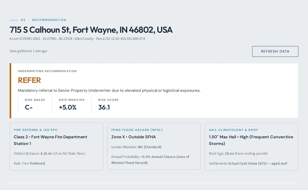
- Flood — FEMA flood zone and whether the property is in a Special Flood Hazard Area.
- Fire protection — the responding fire department, distance to the nearest stations and hydrants, and the ISO Public Protection Class.
- Hail and severe weather — NOAA hail history, tornado paths since 1950, damaging wind reports and hurricane tracks near the property.
- Roof and permits — roofing, HVAC, electrical and plumbing permits, and roof age from permits and aerial imagery.
- Aerial imagery — current and historical imagery, vegetation near the building, and roof change over time.
- Underwriting summary — a risk score with an AI-written summary of the key findings, and a chat to ask follow-up questions about the property.
See a real report
Every report pulls public records and property data together in under a minute. Here are two sections from the report for the Allen County Courthouse in Fort Wayne.


Every report is organized by COPE
COPE is how underwriters size up a property: Construction, Occupancy, Protection and Exposure. MAIT fills in each factor from public records and flags what to confirm with the insured.
Construction
The building materials (wood frame vs. fire-resistive steel and concrete), roof type, number of stories and age of the structure.
MAIT pulls: ISO construction class, walls and frame, stories, year built, square footage, roof covering and roof age from permits and aerial imagery.
Occupancy
How the building is used (residential vs. commercial, office or industrial), the contents stored inside, and tenancy stability.
MAIT pulls: assessor land use, zoning, building style, buildings on the parcel and owner of record. Confirm use, tenancy and contents with the insured.
Protection
Safety and fire-mitigation measures, including automatic sprinklers, smoke and fire alarms, security systems and proximity to the local fire department.
MAIT pulls: ISO fire protection class, the responding fire department, distance to the nearest station and hydrant, and water supply. Confirm sprinklers and alarms with the insured.
Exposure
External hazards from neighboring properties or regional risks, such as wildfire zones, floodplains, windstorm paths and earthquake faults.
MAIT pulls: FEMA flood zone, hail, tornado paths, damaging wind and hurricane history, vegetation and defensible space, and aerial imagery of neighboring buildings.
Pricing
Start with three free property reports, no card required. The Individual plan is for one person with any email address. Agency plans include unlimited users at your agency's email domain, and your whole team shares the monthly report allowance.
Individual
- 125 reports per month
- One user, any email address
- $1.00 per extra report
Starter
- 125 reports per month
- Unlimited agency users
- $1.00 per extra report
Agency
- 500 reports per month
- Unlimited agency users
- $0.90 per extra report
Enterprise
- 1,500 reports per month
- Unlimited agency users
- $0.75 per extra report
A report is one property. Running the same property again in the same billing period isn't counted twice. Extra reports beyond your plan are added to the next monthly invoice. Agency plans need an email address at the agency's own website (not gmail, yahoo and similar). Change plans or cancel anytime. Questions or larger volumes: [email protected].
Reports are compiled from public records and third-party data that may be incomplete or out of date; verify information with the insured before binding. By signing up you agree to the Terms of Service and Privacy Policy.
Your data
MAIT does not sell your information or use it for advertising. Read the MAIT Privacy Policy for what is collected, how it is used and who it is shared with.